January 7-17, 
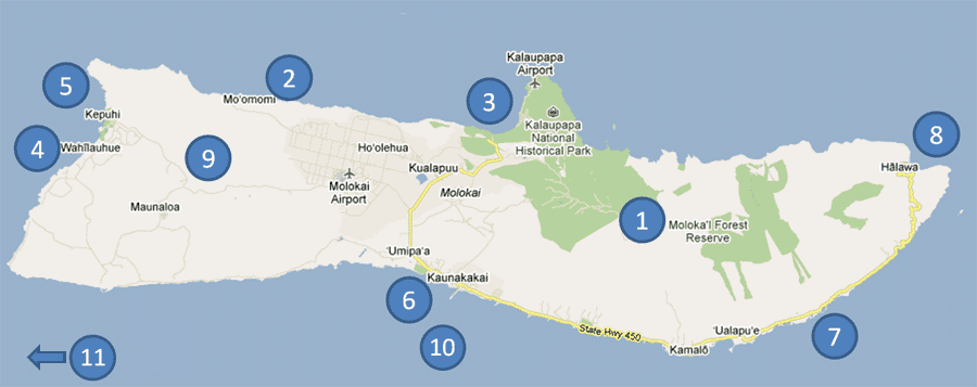
2010
Our Trip to Molokai, Hawaii

Choose a line below, then click on it's numbered circle on the map (numbers are in no order in particular)
1. A hike into the rainforest at the Kamakou reserve
2. A remote shoreline on the northwest coast
3. Kalaupapa and the highlands
4. West end beaches
5. Steve hikes the uninhabited NW coastline

6. The main town of Kaunakakai, and the wharf
7. East end beaches

8. Halawa valley, the flower farm and a hike to a waterfall
9. Views of the landscape along the road to the west end
10. Whale watching off Kaunakakai
11. What's the opposite of Molokai?  Waikiki!


Below are a few videos that I shot while touring Moloka'i on our 2nd visit, in June 2011.
If your connection allows for viewing in HD, do so!  And watch in full screen!

A little beach on the East End, at mile 22


A walkaround of the fabulous house we rented on the east end, at about mile 17. 
Note that this house rented for the price of a nice hotel room at Waikiki!


A view of the shoreline at Mo'omomi. 
We went to the area with a Nature Conservancy group.
Here is a description of their work at Mo'omomi


Taking a nap on the 3-mile long, deserted Papohaku beach
This video was shot in January, when most of the sand is pulled out to sea,
which makes the beach quite a bit narrower and rockier.